|
|
|
| HOME................... |
Map Making
My interest in this subject arose from my interest in making map projections and from reading John Keay's book The Great Arc
Link to my Map projections page
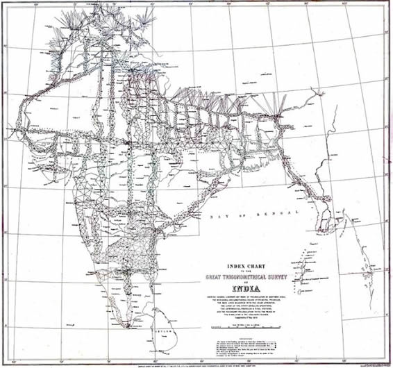
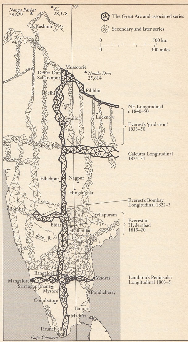
The map on the right shows the triangulation of India as completed in 1870
To increase size press Ctl with + sign
Downlad as pdf
|
 |
| |
|
|
| |
Surveying tools |
Astronomical surveying |
Triangulation methods |
The Great Arc of the Meridian |
The chief personnel in its mapping |
| |
|
|
| |
The tools. These were for measuring vertical and horizontal angles.
Sextant Theodolite |
|
| |
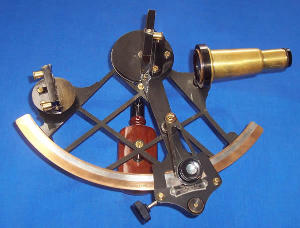
The Sextant.
A sextant was primarily used for hydrographic (coastal and marine) mapping and reconnaissance, rather than high-precision land surveying. Because a sextant is handheld and uses double-reflecting mirrors, it allows a surveyor to measure exact angles between two objects even while standing on the deck of a moving, pitching boat.
Surveyors used a specialized sounding sextant held horizontally to measure the angles between three known landmarks on shore, such as lighthouses, church spires, or flagpoles. By plotting these two adjacent angles on a chart using a three-arm protractor (station pointer), they could pinpoint the exact location where a water depth measurement (sounding) was taken.
When held vertically, a sextant measures the angular height of a landmark with a known physical elevation, such as a cliff or lighthouse. Using basic trigonometry, the surveyor calculates the exact distance from the vessel to the shore.
The sextant is used vertically to measure angles between the horizon and the sun or star to determine latitude.
|
 |
| TOP |
|
|
| |
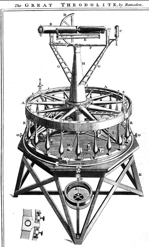
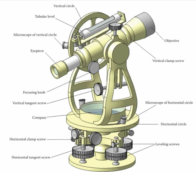
The Theodolite. A theodolite is a precision optical instrument used to measure both horizontal and vertical angles between designated points. Mounted on a tripod, it combines a movable telescope with graduated circles or electronic sensors, making it an essential tool in land surveying, construction, and civil engineering.
|
 |
 |
| |
More on theodolites and their function |
Lambdons great theodolite used in plotting the great arc. It weighed half a ton. |
| |
The use of astronomy in map making (geodetic surveying) |
|
| |
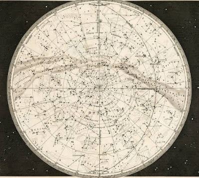
Before satellite navigation existed, astronomical observations were the primary way to establish where a point sat on the globe. Astronomical (or geodetic) surveying was used —to determine exact positions, directions, and elevations on Earth by observing celestial bodies like the Sun, Moon and stars. Because they sit at practically infinite distances, they provide a fixed, universal reference frame.
• Latitude was determined by measuring the altitude (angle above the horizon) of celestial bodies as they cross the local meridian, or by measuring the height of Polaris.
• Longitude was found by comparing the exact local time of a celestial event (like a star reaching its highest point) with the time at a known reference meridian, such as Greenwich, UK. |
 |
| TOP |
|
|
| |
Great Arc of the Meridian
(or the Great Indian Arc of the Meridian) |
| .................. |
My interest in this subect arose from my reading John Keay's book The Great Arc which describes the production of the Great Arc of the Meridian.
It is called the Great Arc of the Meridian (or the Great Indian Arc of the Meridian) because it was a massive, 1,600-mile-long curved measurement running north-to-south along a single line of longitude (the 78th East Meridian) across India. It stretched from India's southern tip at Kanyakumari (Cape Comorin) up to the Himalayan foothills in Mussoorie.
Any straight line measured along the surface of the globe is called an arc because the Earth is a sphere, and a segment of this in geometry is called an arc. Initiated in 1800 by William Lambton and completed by George Everest, this central spine of the Great Trigonometrical Survey was the longest direct measurement of the Earth's surface ever undertaken, taking nearly five decades to complete.
Scientists wanted to measure the exact length of a degree of latitude near the equator to calculate the Earth's true curvature and flattening at the poles. Mapping the Subcontinent. The British East India Company needed accurate, mathematically verified maps to govern territory, collect taxes, and build infrastructure like roads, canals, and railways. Beyond creating the foundation for modern maps of India, the survey's gravitational anomalies helped scientists develop the geological theory of isostasy (how the Earth's crust floats on the mantle). Beyond creating accurate maps for British administration, this measurement helped geodesists determine the exact shape and flattening of the Earth.
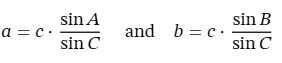
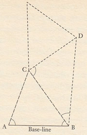
Lambton's base line was between St. Thomas mount near Madras and a hill 7.5 miles to the south. Lambton used a 100ft steel chain. It was supported inside 5 wooden coffers (20 ft long) fitted onto tripods with screws for levelling. The coffers had thermometers for recording the temperature when distance measuremnts were taken. An adjustment for heat induced expansion could then be made by comparison with This was compared with a second chain maintained in a cool vault. Lambton's baseline required 400 measurements with the chain. When measuring the baseline its height above sea level was also determined. All other heights could then be based on this.
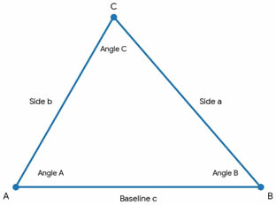
The corners of the triangles were tops of hills or 60 ft towers built for the prupose and conveniently In Tamil Nadu the temple gateways (gopurams) were used.
Accuracy was checked after a long distance by moving to a small triangle with a line that could be measured with the chain. Huge distances were rarely out by more than a couple of inches |
 |
| TOP |
|
|
| |
The chief personnel in the survey |
. |
| |
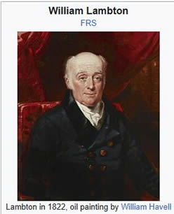
William Lambton (c. 1753–1823). He served as a British Army surveyor in North America during the American War of Independence and was captured at the Battle of Yorktown. He later transferred to India in 1796 and fought in the Fourth Anglo-Mysore War. He who proposed and began the project in 1802 near Madras (modern-day Chennai), leading it until his death in 1823. Lambton was elected a Fellow of the Royal Society for his pioneering work. After his death in Hinganghat, his assistant George Everest
continued the survey, which eventually measured the height of the Himalayas.
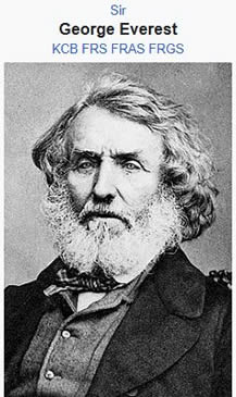
George Everest (1790–1866) was a Welsh surveyor and geographer.
He surveyed Java before becoming chief assistant to William Lambton on the Great Trigonometrical Survey, later succeeding him as superintendent and Surveyor General. He oversaw the completion of the main arc to the Himalayas in the 1840s. The world's highest peak was later named after him.
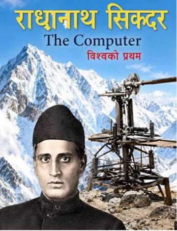
Radhanath Sikdar (1813 – 1870 was a pioneering Indian mathematician and social reformer). He became the "chief computer" for the survey who used the Great Arc's data to calculate that Peak XV (Mount Everest) was the tallest mountain on Earth. His precise mathematical work was central to completing the Great Arc.
|
 |
Radhanath Sikdar |
 |
| TOP |
|
|