This is a collection of bits and pieces on this subject that I found when trying to understand the decison of the United Nations General Assembly to adopt a new world map that formally transitions away from the 16th-century Mercator projection in favour of the Equal Earth projection
The United States cast the sole dissenting vote, dismissing the resolution as "superfluous" and part of a "radical ideological project".
Link to the United Nations statement
Click here for a printable pdf
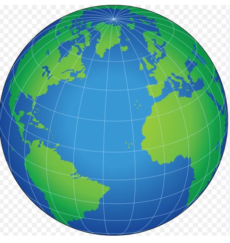
A map projection is a mathematical formula used to transform the three-dimensional, curved surface of the Earth onto a flat, two-dimensional plane. Because a sphere cannot be flattened without tearing, stretching, or compressing it, every flat map contains structural distortions.
Cartographers must choose which geometric metrics to preserve and which to compromise based on the map's purpose. A map projection can maintain some properties perfectly, but never all of them simultaneously.
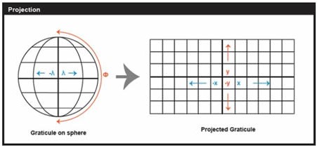
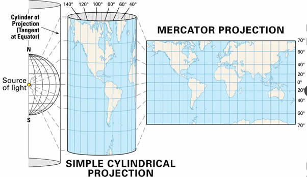
Cylindric projection equations yield graticules with straight meridians and parallels that intersect at right angles.
Conic projections yield straight meridians that converge toward a single point at the poles.
Planar projections also yield straight convergent meridians but form concentric circles rather than arcs.
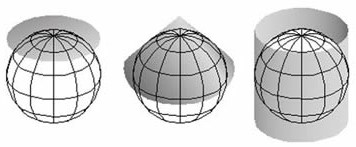
Plane Cone Cylinder
Types of projection
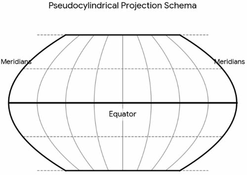
Pseudocylindric projections are variants on cylindrics in which meridians are curved.
The Conic example shown is an Albers Conic Equal Area, which is frequently used for thematic mapping of mid-latitude regions
.
Planar projections are also called azimuthal because every planar projection preserves the property of azimuthality, directions (azimuths) from one or two points to all other points on the map. The projected graticule shown above is the result of an Azimuthal Equidistant projection in its normal polar aspect.
The Transverse Mercator projection is created by rotating a standard Mercator projection by 90 degrees, the cylinder is turned on its side to wrap around a chosen line of longitude. it is one of the most widely used projection types for national and regional maps across the globe including our Ordnance Survery maps. It preserves local angles and shapes
, which means directions are accurate over small local areas.
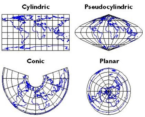
Map Categories depend on the specific metric property they preserve:
Conformal (Orthomorphic) proections: Preserve local angles and shapes. Small circles on the globe remain circles on the map, meaning local directions are accurate. However, area size is often highly distorted. Example: the Mercator projection.
Equal-Area projections. Preserve the relative size of landmasses and oceans. For instance, 1 square inch anywhere on the map represents the exact same number of square miles on Earth. This heavily distorts shapes and angles. For example: the Gall-Peters Projection - a famous cylindrical equal-area projection represents the sizes of developing nations in Africa and South America accurately compared to North America and Europe, though it heavily distorts their vertical shape. The Equal Earth projection is an equal-area pseudocylindrical map projection designed specifically to provide a visually pleasing alternative to the Gall-Peters projection while accurately showing the relative sizes of continents.The Albers Equal-Area Conic Projection is commonly used for mid-latitude regions of large east-west extent, such as the United States or Canada. The Lambert Cylindrical Equal-Area Projection maps the spherical Earth onto a cylinder, keeping areas perfectly proportional but causing extreme distortion near the poles.
Equidistant projections: Maintain accurate distances from one or two designated central points to all other locations on the map. The best known examle is the Azimuthal Equidistant projection which preserves the true scale and direction radiating outward from one single central point. Distances measured from the center to any other spot on the map are completely accurate.
Compromise projections: a cartographic design that does not preserve any single metric perfectly (like area, shape, or distance) but instead distorts all properties slightly. By balancing these distortions, it creates a visually natural-looking, "right" representation of the entire globe for reference maps. A prime example is the Winkel Tripel projection, adopted by the National Geographic Society in 1998 for its standard world maps.
The United Nations proposal to change the standard Mercator projection to the Equal Earth projection
On 4 September 2026, the United Nations General Assembly voted overwhelmingly to adopt a new world map that formally transitions away from the 16th-century Mercator projection in favour of the Equal Earth projection. Link to the United Nations statement
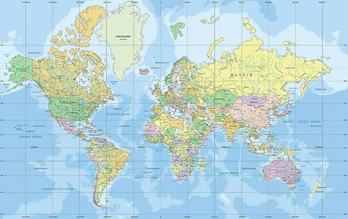
For 457 years, the standard Mercator projection (originally designed in 1569 for maritime navigation) has distorted global perceptions. Because it stretches a spherical Earth onto a flat surface, landmasses near the poles are vastly exaggerated, while land near the equator is compressed.
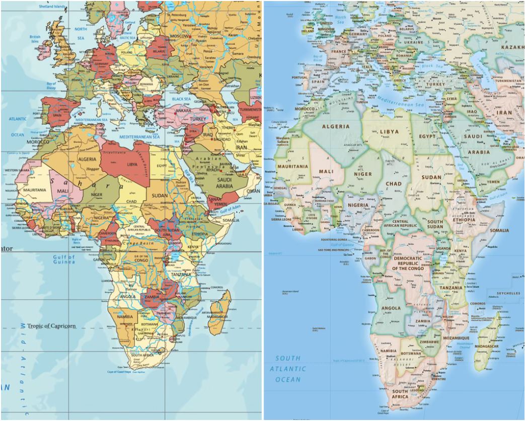
The primary goal of this landmark resolution, titled "Correct the Map" is to correct the "symbolic minimization" and distorted proportions of the traditional world map—most notably regarding the true size of Africa. The old projection makes Europe and North America appear much larger than they actually are, while shrinking the apparent scale of Africa, Latin America, and South Asia. On a standard Mercator map, Greenland looks roughly the same size as Africa. In reality, Africa is 14 times larger than Greenland.
• Conformal: It preserves local angles and shapes around any given point. Because it preserves angles and any straight line drawn on the map is a line of constant compass bearing). This unique mathematical property made it the gold-standard tool for marine navigation after its introduction by Gerardus Mercator in 1569.
• Cylindrical: It is mathematically constructed by conceptually wrapping a cylinder around the Earth . This makes the meridians of longitude equally spaced parallel vertical lines, and the parallels of latitude horizontal straight lines.
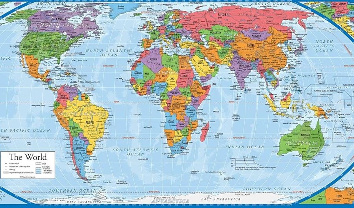
The Equal Earth projection is an equal-area pseudocylindrical map projection designed specifically to provide a visually pleasing alternative to the Gall-Peters projection while accurately showing the relative sizes of continents.
It guarantees that the relative sizes of landmasses are perfectly preserved across the entire map. An area of a specific size anywhere on the globe will cover the exact same amount of area on the map.